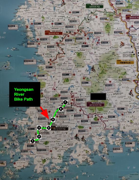
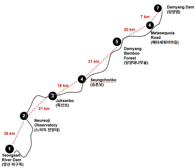
One of Korea’s scenic cross-country bike routes, the Yeongsan River Bike Path begins at the Yeongsan River Dam Bike Certification Center  .
.
To reach the starting point from Seoul, we recommend taking a KTX train to Mokpo (목포). From Mokpo KTX Station, take a local bus to the Yeongsan River Dam certification center.
Both Google Maps and Naver Map suggest this as the most efficient route.
The total travel time is about 4 hours, and the combined KTX and bus fare is approximately $40 per person.
Click the button above to view transportation options via Naver Map.
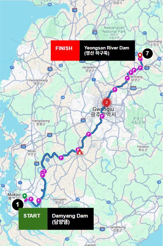
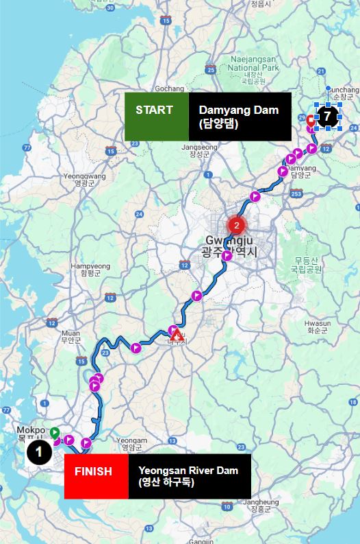
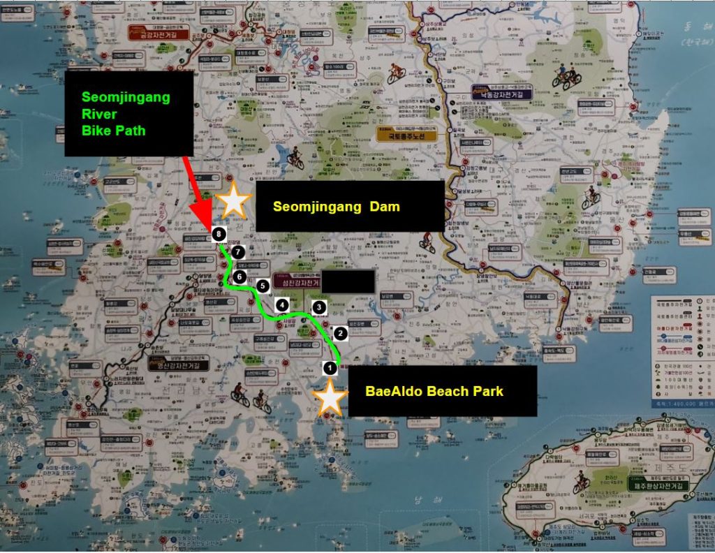
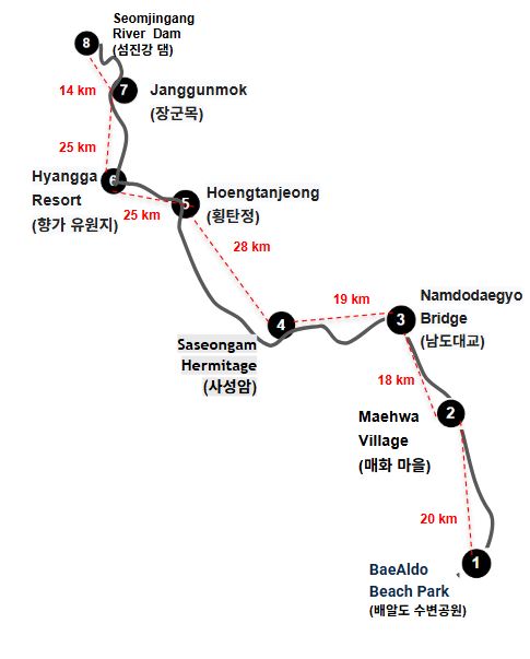
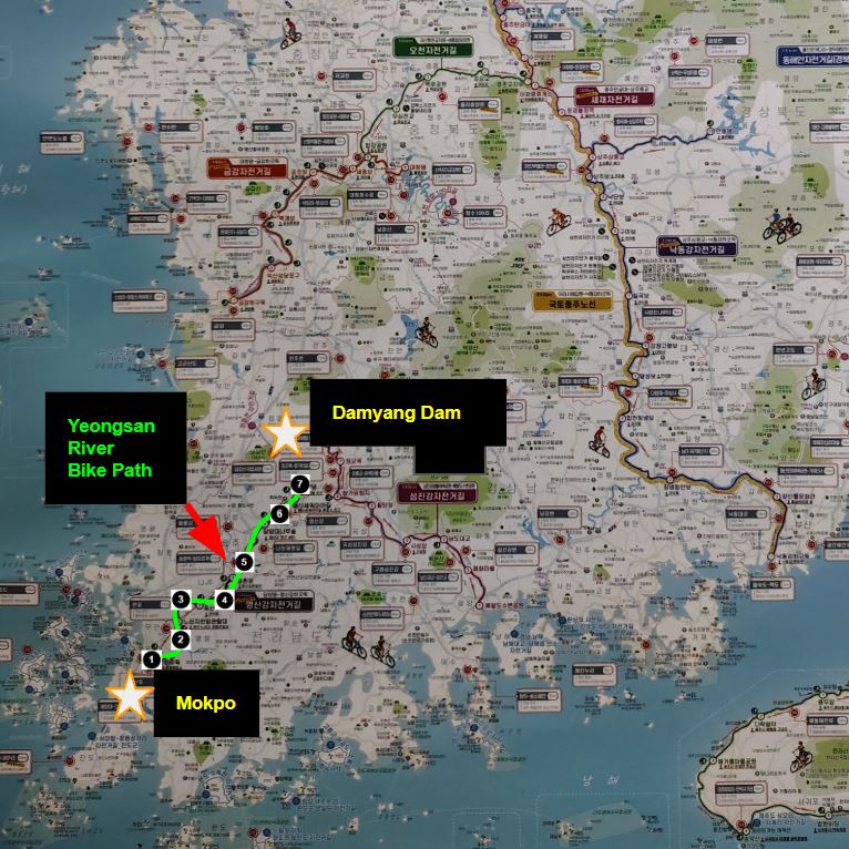
One of Korea’s scenic cross-country bike routes, the Yeongsan River Bike Path begins at the Yeongsan River Dam Bike Certification Center .
To reach the starting point from Seoul, we recommend taking a KTX train to Mokpo (목포). From Mokpo KTX Station, take a local bus to the Yeongsan River Dam certification center.
Both Google Maps and Naver Map suggest this as the most efficient route.
The total travel time is about 4 hours, and the combined KTX and bus fare is approximately $40 per person.
Click the button above to view transportation options via Naver Map.